The hills and valleys are also mapped and rendered in 3D, and many features of America are mapped extensively, including gas stations, hotels etc. This is just a brilliant way to spend a few hours. You can go to the Pyramids, or check out the Grand Canyon. I checked out my parent's house and saw my red car parked out the front. It's just the coolest thing I've seen in a long time.
The entire globe is covered by sattelite images, which are updated on a 3 year rolling basis, so unfortunately you can't check on things in real time, although this is probably a good thing otherwise everyone would be conducting surveillence on each other.
Here is a screen shot of what Google Earth looks like:
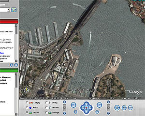
As you can see, Sydney harbour, the Harbour Bridge and the Opera House.
No comments:
Post a Comment